
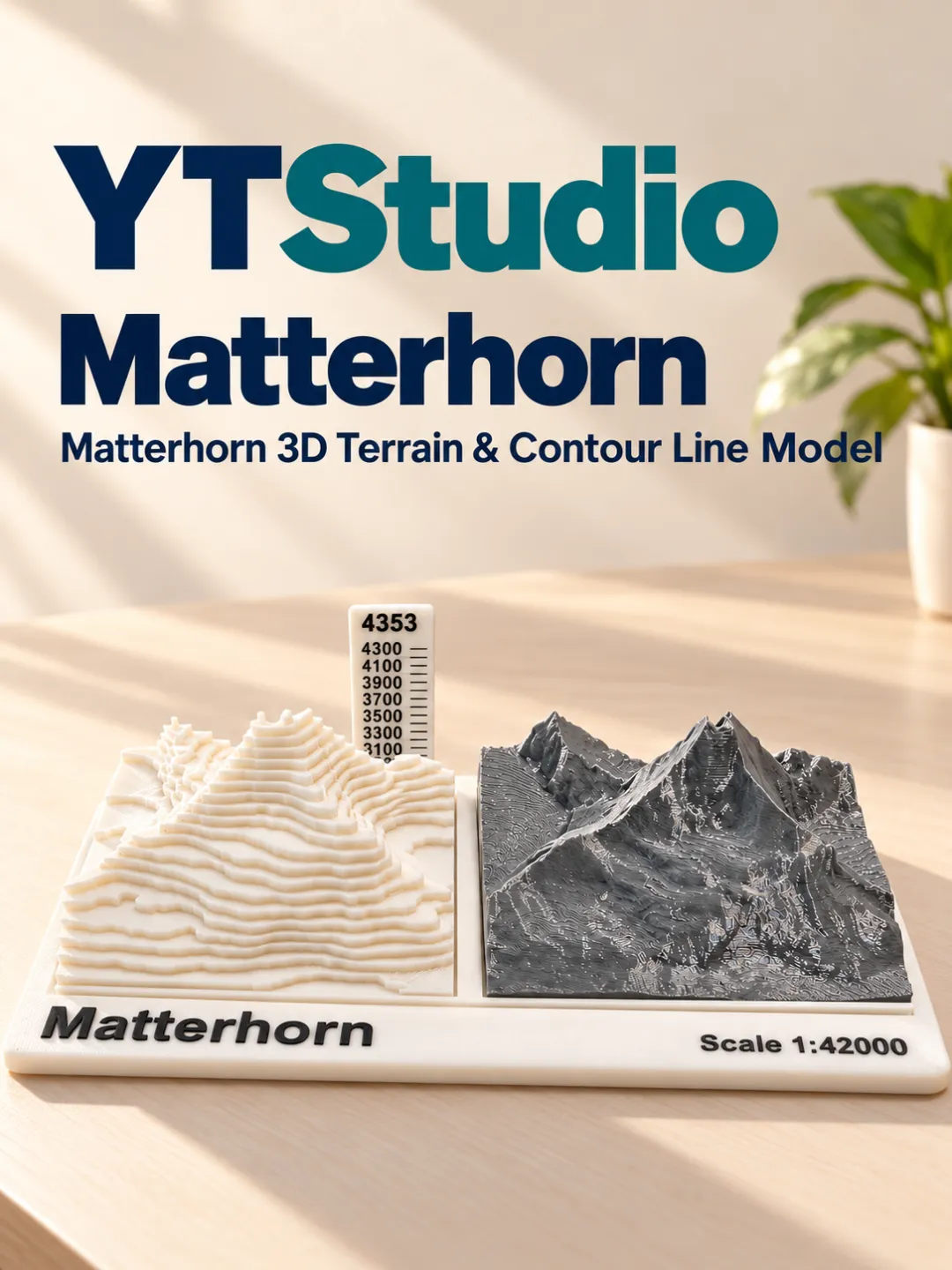
Model Overview & Print Notes
Matterhorn 3D Terrain & Contour Line Model: An Immersive Geographic Learning Experience
Matterhorn: An Icon of the Alps
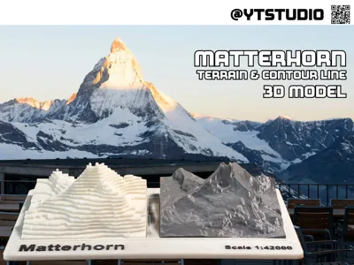
The Matterhorn is one of the most famous mountains in the world, standing at 4,478 meters (14,692 feet) on the Switzerland-Italy border. Its sharp, pyramidal shape makes it a symbol of the Alps and a major attraction for climbers and tourists alike. First ascended in 1865 by Edward Whymper, it remains a challenging climb due to its steep rock faces and unpredictable weather. Visitors to Zermatt, Switzerland, can admire the Matterhorn from scenic viewpoints, explore its rich mountaineering history, or enjoy skiing and hiking in its stunning alpine surroundings.
This educational project features two unique physical models of the Matterhorn—one as a 3D terrain model and the other as a contour line model. Designed specifically for classroom and home-based learning, these models offer students a hands-on way to understand topography, elevation changes, and map interpretation without needing to venture outdoors.
By providing both a realistic landscape representation and a cartographic contour version, students can develop a deeper spatial awareness and gain practical skills in reading maps and understanding terrain changes—all from the comfort of their classroom or home learning environment.
Educational Benefits
1.3D Terrain Model: A Tangible Representation of Geography
- Provides a realistic and detailed depiction of the Matterhorn, helping students visualize mountain slopes, valleys, and elevation differences.
- Encourages tactile learning, allowing students to physically explore and understand topographic variations.
- Helps students connect textbook concepts to real-world landscapes, making geography lessons more engaging and meaningful.
2.Contour Line Model: Mastering Map Interpretation
- Shows how topographic maps represent elevation, making it easier for students to grasp the purpose and function of contour lines.
- Helps students analyze slope gradients, distinguishing between steep and gentle terrain by examining contour spacing.
- Reinforces map-reading skills that are essential for understanding geography and earth science concepts.
How It Enhances Learning at Home & in the Classroom
- Interactive Geography Lessons – Teachers can use the models to visually explain elevation, terrain features, and contour mapping in an engaging way.
- STEM Learning at Home – Parents can integrate the models into homeschooling curricula, making geography lessons more interactive.
- Hands-On Demonstrations – Instead of relying solely on maps and diagrams, students can physically observe and compare real terrain features.
- Independent Exploration – The models encourage curiosity, allowing students to explore and compare geographic features at their own pace.
Conclusion
The Matterhorn 3D Terrain & Contour Line Model is an essential educational tool that transforms geography lessons into interactive, hands-on experiences. Perfect for use in classrooms, homeschooling, or independent study, these models provide a tangible way to learn about topography, elevation, and mapping principles—helping students grasp complex concepts more effectively and enjoyably.
Bring geography to life—explore the Matterhorn from your desk today!
Generating a 3D Model and Contour Model of the Matterhorn
This guide explains how to create both a 3D printable model and a contour model of the Matterhorn using TouchTerrain and QGIS.
Creating a 3D Printable Model (Downloading the STL File from TouchTerrain)
- Go to TouchTerrain and select the Matterhorn area.
- Adjust the selection box to capture the desired terrain.
- Configure settings:
Choose STL as the output format.
Set resolution based on detail requirements.
Adjust Z-scale if needed to enhance elevation.
4. Download the STL file.
Creating a Contour Model
Step 1: Getting Elevation Data from TouchTerrain
- Go to TouchTerrain and select the same Matterhorn area.
- Choose GeoTIFF as the output format.
- Adjust resolution and download the TIFF file.
Step 2: Generating Contours in QGIS
- Load the TIFF file into QGIS.
- Extract contour lines using the contour tool.
- Define contour intervals based on the level of detail needed.
- Export as DXF for CAD compatibility.
Step 3: Refining the Contour Model in CAD
- Import the DXF file into CAD software.
- Edit and organize contour lines for clarity and usability.
- Export the final model for fabrication.




💬MakerWorld Community Comments(6)
★MakerWorld Original Reviews