


Contiguous USA (Lower 48) Topographic Map with Hydrographic Features + Cura Print Settings Profile
Download, slice and print this model in the MakerSpell app — available on Android and Windows. Get the app
Model Overview & Print Notes
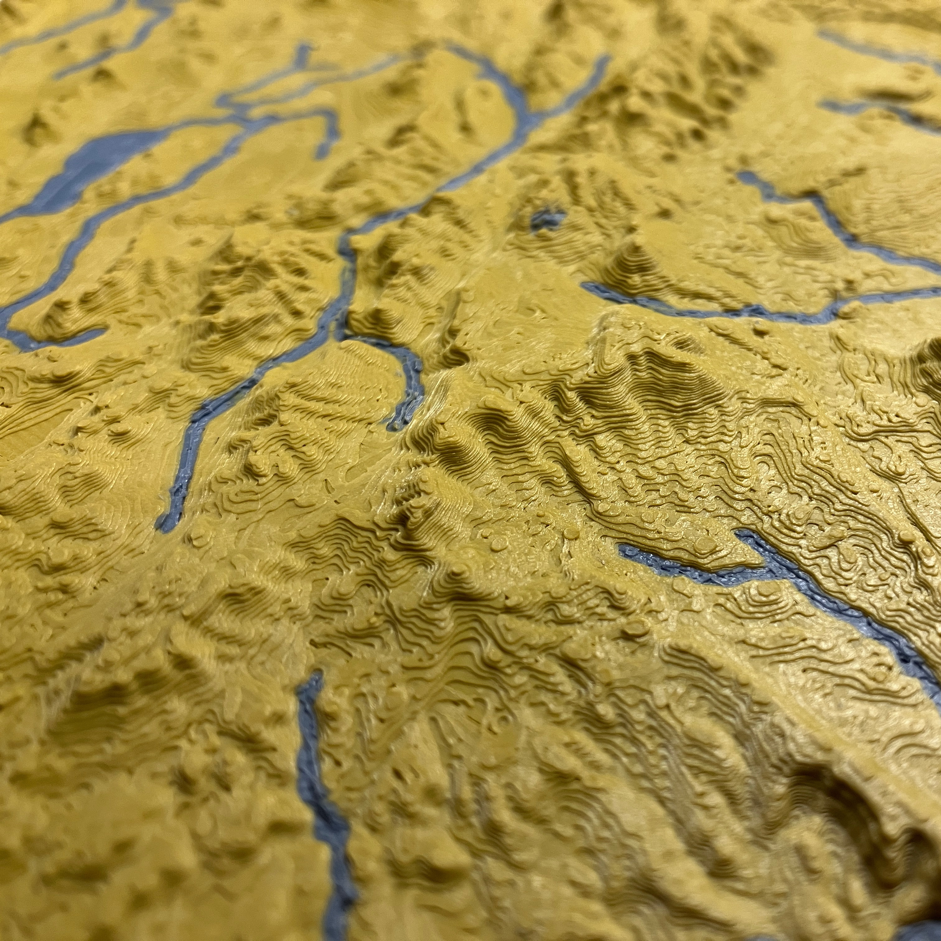
Contiguous United States (Lower 48) Topographic Map with Hydrographic Features For those times when you just want to print everything at once – this is the lower 48 states in the USA of Plastic project combined into a single model. Lower 48 US states' mountains, coastlines, streams, and lakes in a dual color topographic and hydrographic map! This model listing also includes the my latest tuned Cura print settings profile for printing topographic maps. You can find the print profiles in zip format under files. This model is scaled to print on a 180x180mm printer in one piece. If you want to print the water features in a separate color, you may need a smaller nozzle ≤0.1mm in diameter. All topographic states in this USA of Plastic project interlock without gaps. Show off streams, lakes, and coastlines with filament that is glow-in-the-dark, translucent, or simply a different color from the base. Need a special location/map modeled and printed as a showpiece or gift? Contact me ( [email protected] ) for design and production services to bring your idea to life! Which files should you print? See ⭐ or below: The individual 3D printable 3MF files are cut for your convenience and fit together once printed. The files are in 3MF format instead of STL for smaller file size and in order to store separate land and water objects that are aligned for accurate dual color prints. 3MF is supported in Cura, PrusaSlicer, and other 3D slicers. File Description usa-lower-48-dual.3mf ⭐ Dual color model with land and water features. usa-lower-48-dual-transparent.3mf Dual color model with land and water features. Water features go all the way through the land for light transmission with transparent filaments. *usa-lower-48-dual-p N .3mf (optional) Multi-part dual color models. Interlocking piece number N for multi-part print on printers with at least 18 0 mm x 180 mm build area. *usa-lower-48-dual-transparent-p N .3mf (optional) Multi-part dual color models. Interlocking piece number N for multi-part print on printers with at least 180 mm x 180 mm build area. usa-lower-48-single.3mf Single color model with land features and waterways as lines made for single extrusion printers. usa-lower-48-single-vertical-p N .3mf Single color model cut for multi-part vertical printing on the flat side. *If multi-part files are not present, I have not created interlocking models for this yet. Follow me and comment with your request to get future additions and updates. Recommended print settings Print the models as is with a dual extrusion printer. If you have a single extrusion printer, you can either print the usa-lower-48-single.3mf model or run two single extrusion prints utilizing the Z-hop method on the hydrography model. If you want to hide layer lines in the Z, you can slice the map in half and print the two parts vertically laying on the flat cut (see screenshot). Depending on the overhang capability of your printer, you may need to scale down the print in one of horizontal axis. The layer lines will now be in the X or Y axis and can be an interesting effect. I have made a precut version in the usa-lower-48-single-vertical-pN.3mf files. You can scale the model up or down as needed to fit your printer size, the final map's scale will just be scaled accordingly. E.g. 200% scale on a previous scale of 0.4mm:1000m results in 0.4mm:500m Cura may automatically scale the model by 10000% so you need to Select All Models (Ctrl+A) and manually set the Scale to 100% and X/Y/Z position to 0,0,0 for the models to show correctly. Merge (Ctrl+Alt+G) objects in Cura if you rotate them. CartographicSpecifications Value Notes Projection USA Contiguous Lambert Conformal Conic Horizonal Scale 1:25000000 (0.4mm:10000m) Effective resolution is 1000m x 1000m. Territorial waters are included in the dual print models. Vertical Scale 1:500000 (0.1mm:50m) Effective vertical exaggeration is 50x. Elevations 0-40m are scaled between 0 and 0.8mm on a logarithmic scale for enhanced coastal detail. Maritime Boundary Submerged Lands Act Seaward boundary of coastal states generally 3 or 9 nm from the coastline. Credits USAofPlastic topographic map project uses data from NASA SRTM V3.0 , USGS GMTED2010 , USGS HYDRO1K based on 1996 GTOPO30, HydroLAKES , and USCB TIGER/Line . Tools used include QGIS , GDAL , GRASSGIS , TouchTerrain , Anaconda , GeoPandas , Matplotlib , Blender . Please attribute open data and support FOSS software. Tags topography dual usa hydrography usaofplastic transparent topographic hydrographic rivers lakes streams mountains forests canyons valleys wall map cartography gis dem contiguous continental islands